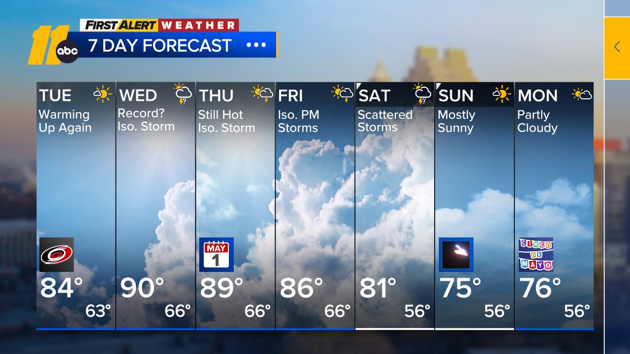
Near-record temperatures are expected Wednesday and Thursday, with rain and storm chances rising toward the weekend.
Good morning! Sunshine dominates today thanks to high pressure off the mid-Atlantic coast. Morning temperatures are in the 40s and 50s across most areas, with afternoon highs reaching the low to mid-80s under mostly sunny skies. Tonight, expect increasing clouds as high pressure drifts farther offshore and a cold front lingers to the northwest.
Temperatures will soar to around 90 degrees on Wednesday while high pressure holds over the region. Look for a mix of sun and clouds, with spotty showers and isolated storms possibly developing by late afternoon.
Thursday’s weather remains mostly dry for the region, though a cold front pushing across the Mississippi Valley could bring activity to areas farther west. Highs will again hover near 90.
Rain and gusty storm chances ramp up late Friday into Saturday as the cold front nears. Highs will settle in the upper 70s to low 80s, while overnight lows dip into the mid-50s.
Sunday brings sunshine and dry conditions behind the front, with highs in the mid-70s.


